Map of Mauryan Empire

About Maurayan Empire Map
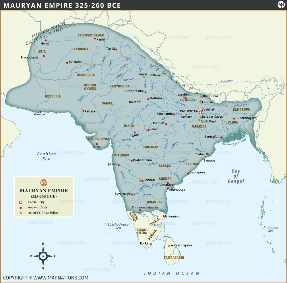
The capital city of Pataliputra, located near the confluence of the Ganges and Son rivers, served as the political and administrative center of the empire. Major cities such as Taxila, Ujjain and Mathura were important centres of trade, education and culture. The map also depicts sites associated with Ashoka's pillar edicts, an important feature of his reign, symbolising his adoption and promotion of Buddhism and his commitment to dharma (righteousness).
The Maurya Empire (325-260 BCE) was one of the largest and most powerful empires in ancient Indian history, founded by Chandragupta Maurya and expanding under his successors, Bindusara and Ashoka the Great. At its peak, the empire stretched from the Hindu Kush mountains in the northwest to the Bay of Bengal in the east and the southern tip of India, excluding parts of modern Tamil Nadu and Kerala. This map provides a detailed view of the Maurya Empire, displaying its geographical extent, major cities, rivers and major historical sites.


