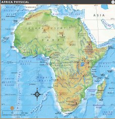
AFRICA PHYSICAL MAP

About Africa Physical Map
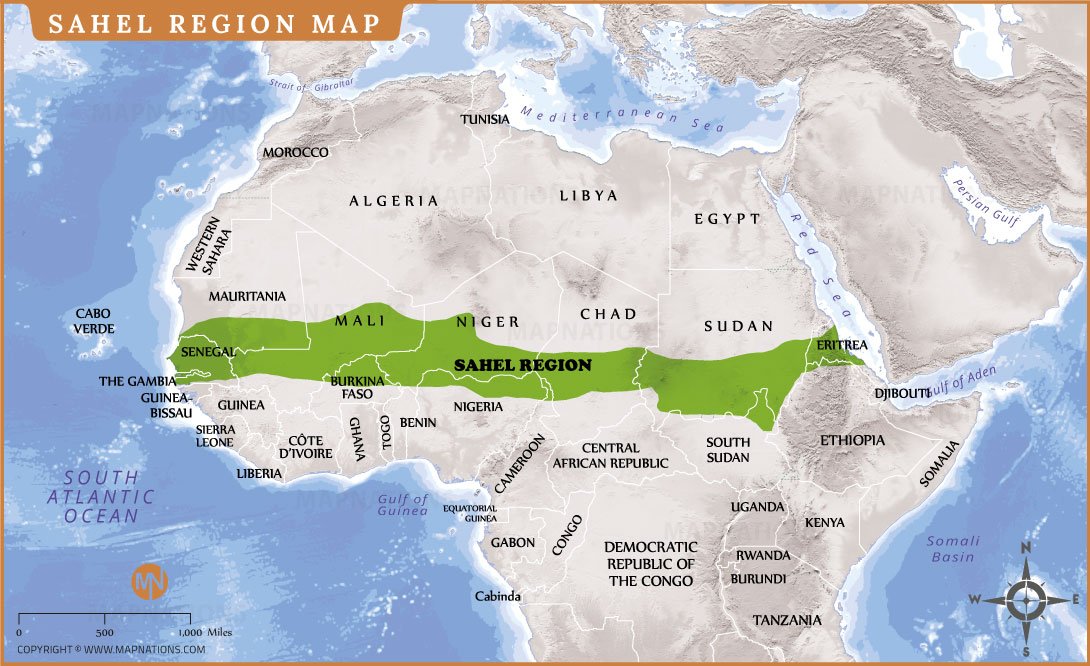
This detailed physical map of Africa shows the continent’s diverse natural features, from high mountain ranges to vast deserts and lush river basins. The Sahara Desert, Sahel region and Ethiopian Highlands are prominently featured. Major mountains include the Atlas Mountains in the northwest and Mount Kilimanjaro, Africa’s highest peak, in the east. The map depicts extensive river systems such as the Nile, Congo and Niger rivers, which are important for water, transportation and agriculture.
Other important features include the Congo Basin, Kalahari Desert, Great Rift Valley and highland plateaus. Coastal features such as the Gulf of Guinea, Mozambique Channel and Cape of Good Hope are clearly marked. Nearby islands such as Madagascar, Seychelles and Mauritius are also included. With detailed topography, this map is ideal for students, researchers and geography enthusiasts who want to understand the physical geography and landscape variations of Africa. It provides a vivid view of elevation changes and natural formations across the continent.