Europe Outline Map

Europe Blank Map

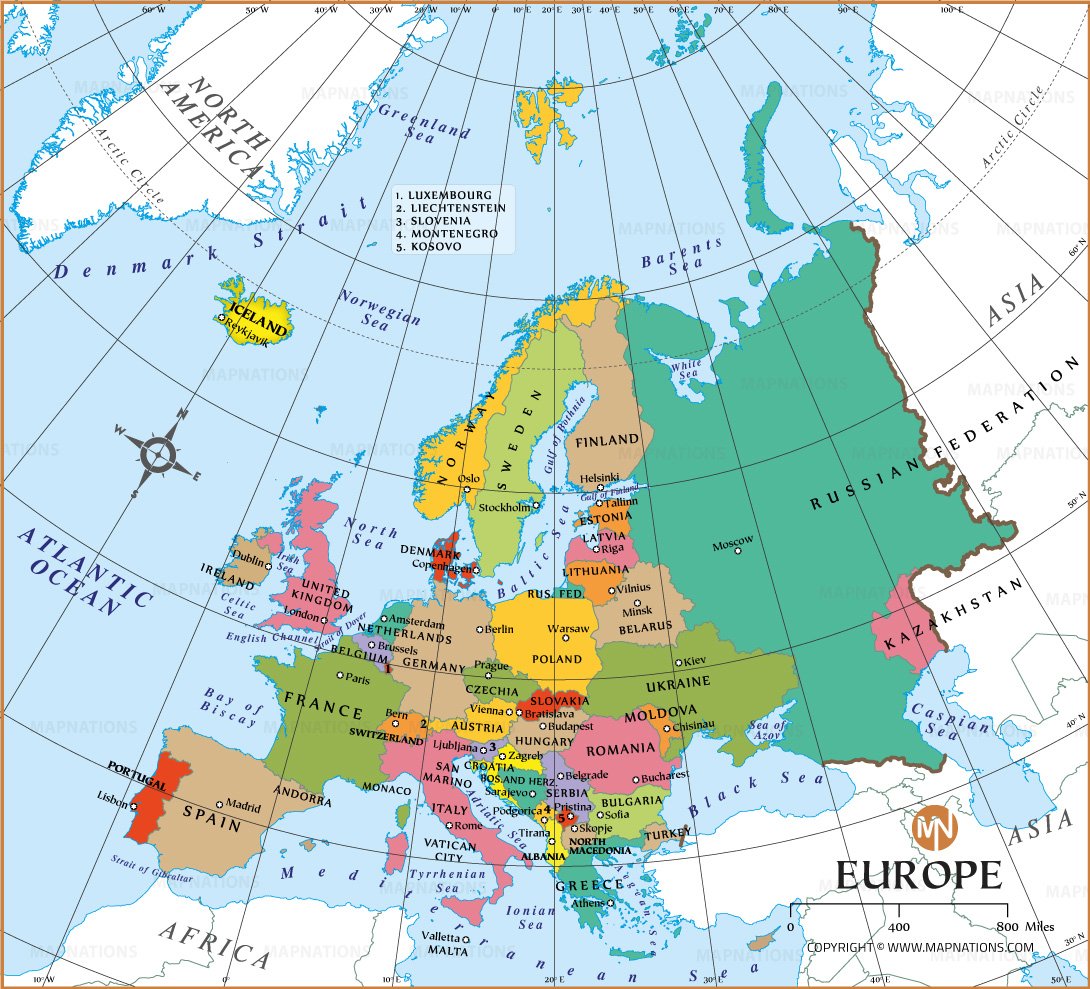
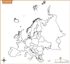
About Europe Outline Map
These Europe maps provide a clear visual representation of the continent's geography. The first image is an outline map showing the borders of European countries, ideal for learning, labeling, or political reference. The second image is a blank map showing Europe's landmass, coastlines, and islands without borders—perfect for educational projects, geographic quizzes, or regional analysis. Both maps are excellent resources for students, researchers, and teachers studying European geography.