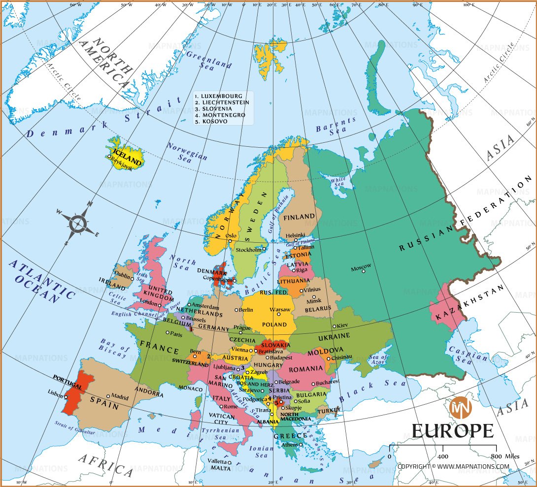
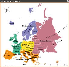
EUROPE REGIONS MAP

This Europe region map classifies the continent into five regions: Northern, Western, Central, Eastern and Southern Europe. Each region is color-coded for clarity, showcasing the countries within their respective regions. Ideal for educational, travel and reference purposes, this map provides a clear geographic overview of Europe's regional divisions.

Europe Regions Map

Explore this Europe region map, highlighting Northern, Western, Central, Eastern and Southern Europe with country divisions and clear labeling.

Size: 24" x 22.5" (WxH) inches

Resolution: 150 Dpi JPG

...
Vintage World Map

This map is a beautifully crafted, vintage-styled representation of the world, Printable size - 29"x18.5 inches (300 Dpi jpg).

...
Map of United States

Printable USA map-25" x 19" inches (300 Dpi jpg) , including state names, state capitals and state boundaries.

EUROPE MAPS

europe-map-thumb
Europe Map
europe-regions-map
Europe Regions Map
Decor Map