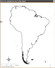
SOUTH AMERICA OUTLINE MAP

SOUTH AMERICA BLANK MAP

South America Outline Map
The outline map of South America displays the continent's boundaries without interior details, ideal for education, geography study or customization. It highlights major coastlines, countries such as the U.S., Canada and Mexico, and surrounding oceans. This versatile map serves as a tool for learning, planning or visually representing the geography of South America.