Red Sea and Gulf of Aden Map

About Red Sea and Gulf of Aden Map
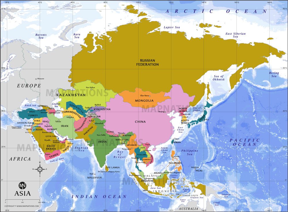
This map illustrates the Red Sea and Gulf of Aden region, highlighting surrounding countries including Saudi Arabia, Yemen, Egypt, Sudan, Eritrea, Djibouti, Somalia, and Ethiopia. Major cities such as Cairo, Riyadh, Sana'a, Djibouti, and Addis Ababa are clearly marked. The map also shows nearby bodies of water including the Mediterranean Sea, Arabian Sea, and Persian Gulf. Important geographic features like coastlines, borders, and islands such as Socotra are displayed. The Red Sea connects to the Gulf of Aden through the Bab el-Mandeb Strait, a vital global shipping route. This map provides valuable geographic context for trade, navigation, geopolitics, and regional understanding of northeastern Africa and the Arabian Peninsula.