Where is Strait of Malacca?

About Where is Malacca Strait?
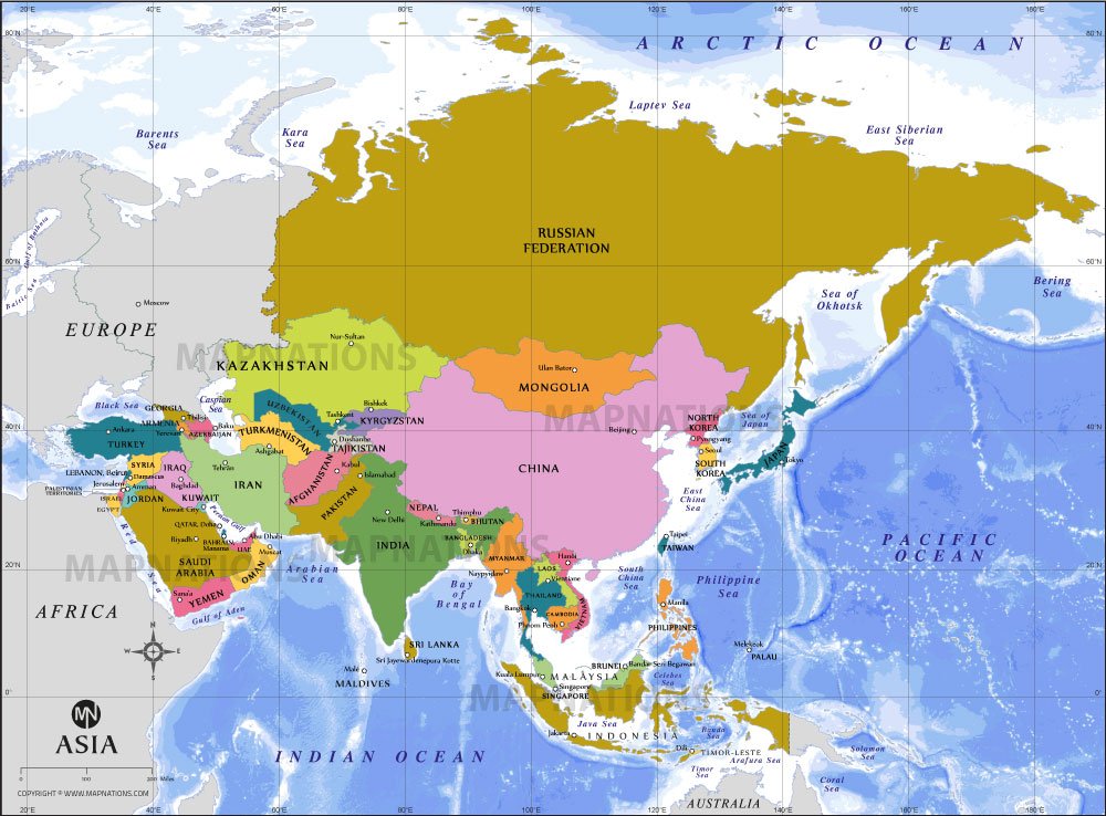
Strait of Malacca map highlights one of the world’s most important maritime passages located between Peninsular Malaysia and the Indonesian island of Sumatra. This narrow waterway connects the Andaman Sea and the South China Sea, forming a critical link between the Indian Ocean and the Pacific Ocean. The map also shows surrounding regions such as Thailand, Cambodia, and parts of Indonesia, providing clear geographic context for the strait’s strategic position. Major nearby water bodies, including the Bay of Bengal, Andaman Sea, and Java Sea, are labeled for easy reference.
This map is useful for understanding global trade routes, as the Malacca Strait is among the busiest shipping lanes in the world. It supports navigation, educational purposes, and geographic study by clearly marking coastlines, boundaries, and regional features around Southeast Asia.