Gupta Empire Map
About Gupta Empire Map
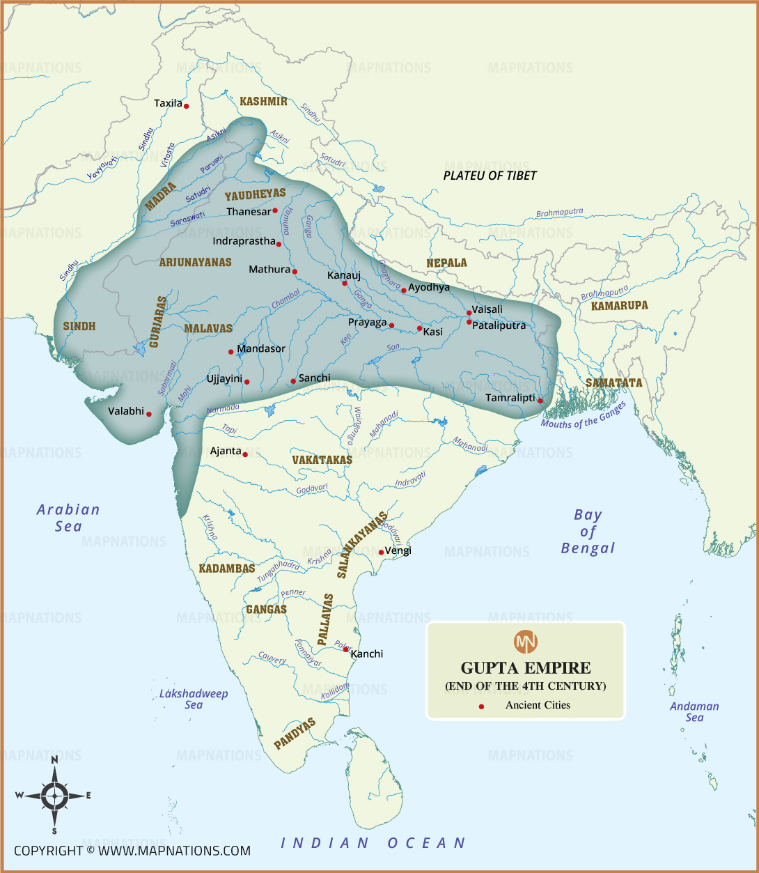
The Gupta Empire Map shows the extent of one of ancient India's most influential empires, which flourished from the 4th to 6th centuries CE. The map highlights the Gupta heartland across northern and central India, along with neighboring kingdoms and important ancient regions. Major cities and historical centers such as Pataliputra, Ayodhya, Mathura, Prayaga, Ujjayini, Kashi, and Kanchi are marked on the map. Important rivers, including the Ganges, Yamuna, Narmada, Godavari, and Brahmaputra, provide geographical context. This historical map also identifies several contemporary kingdoms and regions, helping students and history enthusiasts understand the political geography of India during the Gupta period.