Spartan Territory Map





About Spartan Territory Map
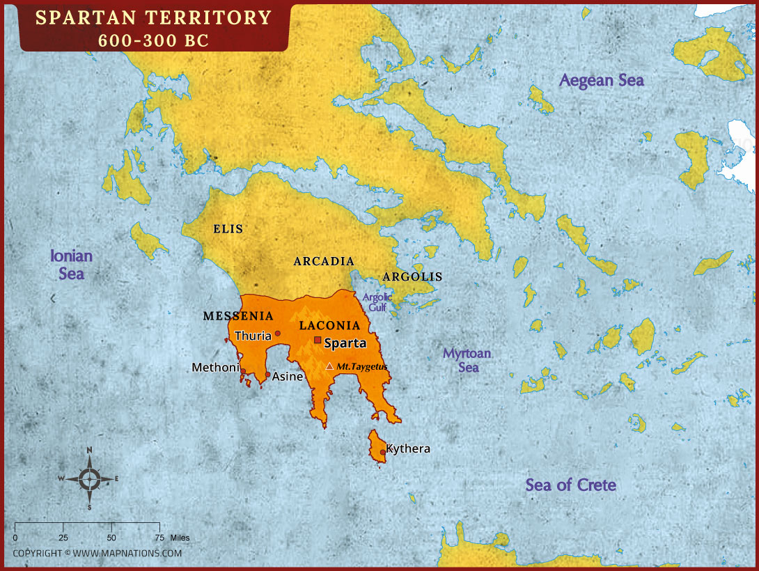
This Spartan Territory Map, covering approximately 600–300 BC, illustrates the historical region of Sparta in ancient Greece. Located in the southeastern Peloponnese, Sparta was the leading city of Laconia and became famous for its powerful military, disciplined society, and influential role in Greek history. The map highlights Laconia in orange, with Sparta marked as its principal city. Nearby regions, including Messenia, Arcadia, Argolis, and Elis, provide geographical context for understanding Sparta's position among other ancient Greek territories.
The map also identifies important locations such as Thuria, Methoni, Asine, Kythera, and Mount Taygetus. The surrounding waters include the Ionian Sea, Aegean Sea, Myrtoan Sea, and Sea of Crete. These geographical features influenced ancient travel, trade, communication, and military campaigns. This historical map helps students, teachers, history enthusiasts, and researchers explore Sparta's territory and understand the geography of the Peloponnese during the Classical Greek period.