Maratha Empire Map
About Maratha Empire Map
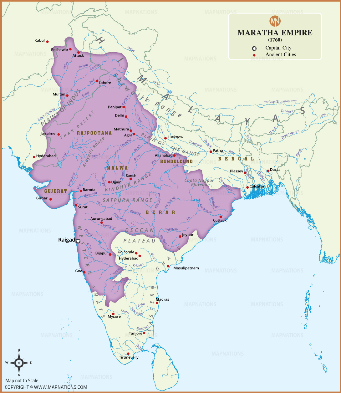
The Maratha Empire Map of 1760 illustrates the extensive territory controlled or influenced by the Marathas during the 18th century. The map highlights major regions including Malwa, Rajputana, Gujarat, Bundelkhand, Berar, and the Deccan, along with important cities such as Pune, Delhi, Agra, Surat, Ujjain, Hyderabad, and Cuttack. It also shows major rivers, mountain ranges, plains, and surrounding historical territories, providing useful geographical context for understanding Maratha expansion. Key locations such as Raigad, Panipat, Lahore, and Calcutta are marked for historical reference. This detailed historical map helps students, researchers, and history enthusiasts visualize the geographical extent and major centers associated with the Maratha Empire around 1760.