MYANMAR MAP

About Myanmar Map
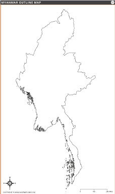
Map of Myanmar shows the country's territorial boundaries, region capitals, major roads, rivers and neighboring countries including India, China, Thailand, Laos and Bangladesh. The map highlights Myanmar's capital Naypyidaw with a distinct symbol and shows major cities such as Yangon, Mandalay and Myitkyina. Water bodies such as the Bay of Bengal, the Andaman Sea and the Gulf of Thailand are also clearly labeled. Ideal for educational, research or travel planning purposes, this map provides a comprehensive view of Myanmar's geography and administrative divisions. Designed with clarity and accuracy, it serves as a valuable reference for both students and professionals.
Frequently Asked Questions about the Myanmar
1. Where is Myanmar located?
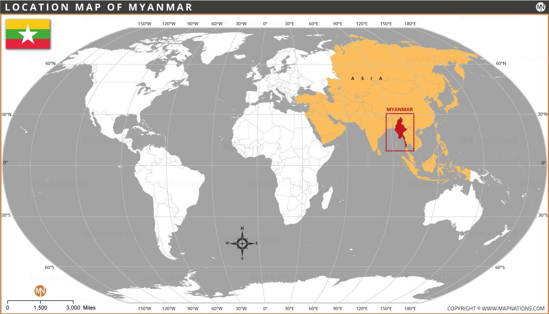
Myanmar is located in Southeast Asia and shares borders with India, Bangladesh, China, Laos, and Thailand.
2. What is the capital of Myanmar?
The capital city of Myanmar is Naypyidaw, while Yangon is the country's largest city and main commercial center.
3. What is the official currency of Myanmar?
The official currency of Myanmar is the Myanmar Kyat (MMK).
4. What language is spoken in Myanmar?
Burmese is the official language of Myanmar and is spoken by the majority of the population.
5. What are the major tourist attractions in Myanmar?
Popular attractions include Bagan, Shwedagon Pagoda, Inle Lake, Mandalay, Ngapali Beach, and Kyaiktiyo Golden Rock.
6. What is Myanmar known for?
Myanmar is known for its ancient temples, rich Buddhist heritage, diverse ethnic cultures, and scenic landscapes.
7. What is the best time to visit Myanmar?
The best time to visit Myanmar is from November to February when the weather is cooler and drier, making travel more comfortable.


- Afghanistan
- Albania
- Algeria
- Andorra
- Angola
- Antigua and Barbuda
- Argentina
- Armenia
- Australia
- Austria
- Azerbaijan
- Bahrain
- Bangladesh
- Barbados
- Belarus
- Belgium
- Belize
- Benin
- Bhutan
- Bolivia
- Bosnia and Herzegovina
- Botswana
- Brazil
- Brunei
- Bulgaria
- Burkina Faso
- Burma (Myanmar)
- Burundi
- Cabo Verde
- Cambodia
- Cameroon
- Canada
- Central African Republic
- Chad
- Chile
- China
- Colombia
- Comoros Islands
- Democratic Republic of the Congo
- Costa Rica
- Cote d'Ivoire
- Croatia
- Cuba
- Cyprus
- Czechia
- Denmark
- Djibouti
- Dominica
- Dominican Republic
- Ecuador
- Egypt
- El Salvador
- England
- Equatorial Guinea
- Eritrea
- Estonia
- eSwatini (formerly Swaziland)
- Ethiopia
- Federated States of Micronesia
- Fiji
- Finland
- France
- Gabon
- The Gambia
- Georgia
- Germany
- Ghana
- Greece
- Grenada
- Guatemala
- Guinea
- Guinea-Bissau
- Guyana
- Haiti
- Holy See
- Honduras
- Hungary
- Iceland
- India
- Indonesia
- Iran
- Iraq
- Ireland
- Israel
- Italy
- Jamaica
- Japan
- Jordan
- Kazakhstan
- Kenya
- Kiribati
- Kosovo
- Kuwait
- Kyrgyzstan
- Laos
- Latvia
- Lebanon
- Lesotho
- Liberia
- Libya
- Liechtenstein
- Lithuania
- Luxembourg
- Madagascar
- Malawi
- Malaysia
- Maldives
- Mali
- Malta
- Marshall Islands
- Mauritania
- Mauritius
- Mexico
- Moldova
- Monaco
- Mongolia
- Montenegro
- Morocco
- Mozambique
- Namibia
- Nauru
- Nepal
- Netherlands
- New Zealand
- Nicaragua
- Niger
- Nigeria
- North Korea
- Northern Ireland
- Norway
- Oman
- Pakistan
- Palau
- Panama
- Papua New Guinea
- Paraguay
- Peru
- Philippines
- Poland
- Portugal
- Puerto Rico (USA)
- Qatar
- North Macedonia
- Romania
- Russia
- Rwanda
- Saint Kitts and Nevis
- Saint Lucia
- Saint Vincent & the Grenadines
- Samoa
- San Marino
- Sao Tome and Principe
- Saudi Arabia
- Scotland
- Senegal
- Serbia
- Seychelles
- Sierra Leone
- Singapore
- Slovakia
- Slovenia
- Solomon Islands
- Somalia
- South Africa
- South Korea
- South Sudan
- Spain
- Sri Lanka
- Sudan
- Suriname
- Sweden
- Switzerland
- Syria
- Tajikistan
- Taiwan
- Tanzania
- Thailand
- The Bahamas
- Timor-Leste
- Togo
- Tonga
- Trinidad and Tobago
- Tunisia
- Turkey
- Turkmenistan
- Tuvalu
- Uganda
- Ukraine
- United Arab Emirates
- United Kingdom
- United States of America
- Uruguay
- Uzbekistan
- Vanuatu
- Western Sahara
- Venezuela
- Vietnam
- Wales
- Yemen
- Zambia
- Zimbabwe
