BHUTAN MAP

About Bhutan Map
This detailed political map of Bhutan provides an informative view of the country's administrative divisions, including all 20 districts (Dzongkhags) with clear boundaries and labels. Major cities such as Thimphu, the capital, are marked along with district capitals, major roads, rivers, and prominent mountain peaks like Kula Kangri and Chomo Lhari. The map also indicates Bhutan’s borders with China and India. It serves as an excellent visual reference for educators, students, travelers, and anyone interested in Bhutan's geography. The map is professionally designed and includes a locator inset showing Bhutan’s position in the world. Ideal for both digital and print use.
Frequently Asked Questions about the Bhutan
1. Where is Bhutan located?
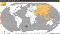
Bhutan is a small landlocked country in the eastern Himalayas, situated between India and China in South Asia.
2. What is the capital of Bhutan?
The capital city of Bhutan is Thimphu, which is also the country's largest city and administrative center.
3. What is Bhutan famous for?
Bhutan is known for its stunning Himalayan landscapes, Buddhist culture, monasteries, and its unique Gross National Happiness (GNH) philosophy.
4. What is the official language of Bhutan?
The official language of Bhutan is Dzongkha, although English is widely used in education and government.
5. What currency is used in Bhutan?
Bhutan uses the Bhutanese Ngultrum (BTN), which is pegged at par with the Indian Rupee (INR).
6. Do tourists need a visa to visit Bhutan?
Most foreign visitors require a visa before entering Bhutan. Tourists usually arrange visas through authorized tour operators.
7. What are the major tourist attractions in Bhutan?
Popular attractions include Tiger's Nest Monastery, Paro, Thimphu, Punakha Dzong, and the scenic Himalayan valleys that attract travelers from around the world.


- Afghanistan
- Albania
- Algeria
- Andorra
- Angola
- Antigua and Barbuda
- Argentina
- Armenia
- Australia
- Austria
- Azerbaijan
- Bahrain
- Bangladesh
- Barbados
- Belarus
- Belgium
- Belize
- Benin
- Bhutan
- Bolivia
- Bosnia and Herzegovina
- Botswana
- Brazil
- Brunei
- Bulgaria
- Burkina Faso
- Burma (Myanmar)
- Burundi
- Cabo Verde
- Cambodia
- Cameroon
- Canada
- Central African Republic
- Chad
- Chile
- China
- Colombia
- Comoros Islands
- Democratic Republic of the Congo
- Costa Rica
- Cote d'Ivoire
- Croatia
- Cuba
- Cyprus
- Czechia
- Denmark
- Djibouti
- Dominica
- Dominican Republic
- Ecuador
- Egypt
- El Salvador
- England
- Equatorial Guinea
- Eritrea
- Estonia
- eSwatini (formerly Swaziland)
- Ethiopia
- Federated States of Micronesia
- Fiji
- Finland
- France
- Gabon
- The Gambia
- Georgia
- Germany
- Ghana
- Greece
- Grenada
- Guatemala
- Guinea
- Guinea-Bissau
- Guyana
- Haiti
- Holy See
- Honduras
- Hungary
- Iceland
- India
- Indonesia
- Iran
- Iraq
- Ireland
- Israel
- Italy
- Jamaica
- Japan
- Jordan
- Kazakhstan
- Kenya
- Kiribati
- Kosovo
- Kuwait
- Kyrgyzstan
- Laos
- Latvia
- Lebanon
- Lesotho
- Liberia
- Libya
- Liechtenstein
- Lithuania
- Luxembourg
- Madagascar
- Malawi
- Malaysia
- Maldives
- Mali
- Malta
- Marshall Islands
- Mauritania
- Mauritius
- Mexico
- Moldova
- Monaco
- Mongolia
- Montenegro
- Morocco
- Mozambique
- Namibia
- Nauru
- Nepal
- Netherlands
- New Zealand
- Nicaragua
- Niger
- Nigeria
- North Korea
- Northern Ireland
- Norway
- Oman
- Pakistan
- Palau
- Panama
- Papua New Guinea
- Paraguay
- Peru
- Philippines
- Poland
- Portugal
- Puerto Rico (USA)
- Qatar
- North Macedonia
- Romania
- Russia
- Rwanda
- Saint Kitts and Nevis
- Saint Lucia
- Saint Vincent & the Grenadines
- Samoa
- San Marino
- Sao Tome and Principe
- Saudi Arabia
- Scotland
- Senegal
- Serbia
- Seychelles
- Sierra Leone
- Singapore
- Slovakia
- Slovenia
- Solomon Islands
- Somalia
- South Africa
- South Korea
- South Sudan
- Spain
- Sri Lanka
- Sudan
- Suriname
- Sweden
- Switzerland
- Syria
- Tajikistan
- Taiwan
- Tanzania
- Thailand
- The Bahamas
- Timor-Leste
- Togo
- Tonga
- Trinidad and Tobago
- Tunisia
- Turkey
- Turkmenistan
- Tuvalu
- Uganda
- Ukraine
- United Arab Emirates
- United Kingdom
- United States of America
- Uruguay
- Uzbekistan
- Vanuatu
- Western Sahara
- Venezuela
- Vietnam
- Wales
- Yemen
- Zambia
- Zimbabwe
