CENTRAL AFRICAN REPUBLIC MAP

About Central African Republic Map
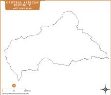
This detailed map of the Central African Republic presents administrative divisions, major cities, transport routes, rivers, and national parks in a clear layout. It highlights provincial boundaries, prefectures capitals, and the national capital Bangui, helping users understand political and geographic organization. Neighboring countries including Chad, Sudan, South Sudan, Cameroon, Congo, and the Democratic Republic of the Congo are clearly labeled. Major rivers and road networks support regional orientation. Ideal for education, research, travel planning, and cartographic reference, this map offers an accurate visual overview of Central Africa’s landlocked nation, with updated styling, balanced colors, and easy-to-read symbols throughout mapwide clarity.
Frequently Asked Questions about the Cental African Republic
1. Where is the Central African Republic located?
The Central African Republic (CAR) is a landlocked country in Central Africa. It borders Chad, Sudan, South Sudan, the Democratic Republic of the Congo, the Republic of the Congo, and Cameroon.
2. What is the capital city of the Central African Republic?
Bangui is the capital and largest city of the Central African Republic. It is located along the Ubangi River in the southwestern part of the country.
3. What is the population of the Central African Republic?
The Central African Republic has a population of approximately 5.5 million people, though estimates may vary depending on the source and year.
4. What are the official languages of the Central African Republic?
The country has two official languages: French and Sango. Sango is widely spoken and serves as a lingua franca across the nation.
5. What is the currency used in the Central African Republic?
The official currency is the Central African CFA Franc (XAF), which is shared by several countries in Central Africa.
6. What are the major attractions in the Central African Republic?
Notable attractions include Manovo-Gounda St. Floris National Park, Dzanga-Sangha National Reserve, Andre Felix National Park, and the country's rich wildlife and tropical forests.
7. What is the Central African Republic known for?
The Central African Republic is known for its diverse wildlife, vast rainforests, natural resources such as diamonds and gold, and unique cultural heritage.


- Afghanistan
- Albania
- Algeria
- Andorra
- Angola
- Antigua and Barbuda
- Argentina
- Armenia
- Australia
- Austria
- Azerbaijan
- Bahrain
- Bangladesh
- Barbados
- Belarus
- Belgium
- Belize
- Benin
- Bhutan
- Bolivia
- Bosnia and Herzegovina
- Botswana
- Brazil
- Brunei
- Bulgaria
- Burkina Faso
- Burma (Myanmar)
- Burundi
- Cabo Verde
- Cambodia
- Cameroon
- Canada
- Central African Republic
- Chad
- Chile
- China
- Colombia
- Comoros Islands
- Democratic Republic of the Congo
- Costa Rica
- Cote d'Ivoire
- Croatia
- Cuba
- Cyprus
- Czechia
- Denmark
- Djibouti
- Dominica
- Dominican Republic
- Ecuador
- Egypt
- El Salvador
- England
- Equatorial Guinea
- Eritrea
- Estonia
- eSwatini (formerly Swaziland)
- Ethiopia
- Federated States of Micronesia
- Fiji
- Finland
- France
- Gabon
- The Gambia
- Georgia
- Germany
- Ghana
- Greece
- Grenada
- Guatemala
- Guinea
- Guinea-Bissau
- Guyana
- Haiti
- Holy See
- Honduras
- Hungary
- Iceland
- India
- Indonesia
- Iran
- Iraq
- Ireland
- Israel
- Italy
- Jamaica
- Japan
- Jordan
- Kazakhstan
- Kenya
- Kiribati
- Kosovo
- Kuwait
- Kyrgyzstan
- Laos
- Latvia
- Lebanon
- Lesotho
- Liberia
- Libya
- Liechtenstein
- Lithuania
- Luxembourg
- Madagascar
- Malawi
- Malaysia
- Maldives
- Mali
- Malta
- Marshall Islands
- Mauritania
- Mauritius
- Mexico
- Moldova
- Monaco
- Mongolia
- Montenegro
- Morocco
- Mozambique
- Namibia
- Nauru
- Nepal
- Netherlands
- New Zealand
- Nicaragua
- Niger
- Nigeria
- North Korea
- Northern Ireland
- Norway
- Oman
- Pakistan
- Palau
- Panama
- Papua New Guinea
- Paraguay
- Peru
- Philippines
- Poland
- Portugal
- Puerto Rico (USA)
- Qatar
- North Macedonia
- Romania
- Russia
- Rwanda
- Saint Kitts and Nevis
- Saint Lucia
- Saint Vincent & the Grenadines
- Samoa
- San Marino
- Sao Tome and Principe
- Saudi Arabia
- Scotland
- Senegal
- Serbia
- Seychelles
- Sierra Leone
- Singapore
- Slovakia
- Slovenia
- Solomon Islands
- Somalia
- South Africa
- South Korea
- South Sudan
- Spain
- Sri Lanka
- Sudan
- Suriname
- Sweden
- Switzerland
- Syria
- Tajikistan
- Taiwan
- Tanzania
- Thailand
- The Bahamas
- Timor-Leste
- Togo
- Tonga
- Trinidad and Tobago
- Tunisia
- Turkey
- Turkmenistan
- Tuvalu
- Uganda
- Ukraine
- United Arab Emirates
- United Kingdom
- United States of America
- Uruguay
- Uzbekistan
- Vanuatu
- Western Sahara
- Venezuela
- Vietnam
- Wales
- Yemen
- Zambia
- Zimbabwe
