England Map

About England Map
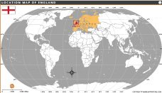
Map of England presents a comprehensive view of the country’s cities, rivers, and major road networks. It highlights key urban centers such as London, Manchester, Birmingham, and Bristol, while also showcasing natural features like major rivers and coastlines. Each region is color-coded and clearly marked, helping to distinguish administrative boundaries across the regions. The map includes transportation links and major roads that connect cities and towns throughout England, making it a valuable resource for travelers, educators, students, and professionals. Whether you're exploring for educational purposes, planning a journey, or seeking geographic context, this map offers a clear and informative layout of England’s diverse landscape.
Frequently Asked Questions about the England
1. What is England famous for?
England is famous for its royal heritage, historic landmarks, football culture, castles, literature, and cities like London and Manchester.
2. What is the capital of England?
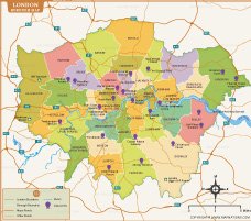
London is the capital city of England and one of the world’s leading financial, cultural, and tourist destinations.
3. What currency is used in England?
England uses the British Pound Sterling (£), which is the official currency of the United Kingdom.
4. What language is spoken in England?
English is the official and most widely spoken language throughout England.
5. What are the major tourist attractions in England?
Popular attractions include Buckingham Palace, Tower of London, Stonehenge, Lake District, Big Ben, and Windsor Castle.
6. What is the population of England?
England has a population of approximately 57 million people, making it the most populated country in the United Kingdom.
7. What is the best time to visit England?
The best time to visit England is from late spring to early autumn, especially between May and September, for pleasant weather.
8. What are the best places to visit in England?
Some of the best places to visit in England include London, Stonehenge, the Lake District, Windsor Castle, York, Bath, the Cotswolds, Cornwall, Oxford, Cambridge, Brighton, Canterbury, the Peak District, the White Cliffs of Dover, and Liverpool. These destinations offer a mix of historic landmarks, beautiful countryside, stunning coastlines, world-famous universities, and vibrant cities, making England an excellent destination for every type of traveler.


- Afghanistan
- Albania
- Algeria
- Andorra
- Angola
- Antigua and Barbuda
- Argentina
- Armenia
- Australia
- Austria
- Azerbaijan
- Bahrain
- Bangladesh
- Barbados
- Belarus
- Belgium
- Belize
- Benin
- Bhutan
- Bolivia
- Bosnia and Herzegovina
- Botswana
- Brazil
- Brunei
- Bulgaria
- Burkina Faso
- Burma (Myanmar)
- Burundi
- Cabo Verde
- Cambodia
- Cameroon
- Canada
- Central African Republic
- Chad
- Chile
- China
- Colombia
- Comoros Islands
- Democratic Republic of the Congo
- Costa Rica
- Cote d'Ivoire
- Croatia
- Cuba
- Cyprus
- Czechia
- Denmark
- Djibouti
- Dominica
- Dominican Republic
- Ecuador
- Egypt
- El Salvador
- England
- Equatorial Guinea
- Eritrea
- Estonia
- eSwatini (formerly Swaziland)
- Ethiopia
- Federated States of Micronesia
- Fiji
- Finland
- France
- Gabon
- The Gambia
- Georgia
- Germany
- Ghana
- Greece
- Grenada
- Guatemala
- Guinea
- Guinea-Bissau
- Guyana
- Haiti
- Holy See
- Honduras
- Hungary
- Iceland
- India
- Indonesia
- Iran
- Iraq
- Ireland
- Israel
- Italy
- Jamaica
- Japan
- Jordan
- Kazakhstan
- Kenya
- Kiribati
- Kosovo
- Kuwait
- Kyrgyzstan
- Laos
- Latvia
- Lebanon
- Lesotho
- Liberia
- Libya
- Liechtenstein
- Lithuania
- Luxembourg
- Madagascar
- Malawi
- Malaysia
- Maldives
- Mali
- Malta
- Marshall Islands
- Mauritania
- Mauritius
- Mexico
- Moldova
- Monaco
- Mongolia
- Montenegro
- Morocco
- Mozambique
- Namibia
- Nauru
- Nepal
- Netherlands
- New Zealand
- Nicaragua
- Niger
- Nigeria
- North Korea
- Northern Ireland
- Norway
- Oman
- Pakistan
- Palau
- Panama
- Papua New Guinea
- Paraguay
- Peru
- Philippines
- Poland
- Portugal
- Puerto Rico (USA)
- Qatar
- North Macedonia
- Romania
- Russia
- Rwanda
- Saint Kitts and Nevis
- Saint Lucia
- Saint Vincent & the Grenadines
- Samoa
- San Marino
- Sao Tome and Principe
- Saudi Arabia
- Scotland
- Senegal
- Serbia
- Seychelles
- Sierra Leone
- Singapore
- Slovakia
- Slovenia
- Solomon Islands
- Somalia
- South Africa
- South Korea
- South Sudan
- Spain
- Sri Lanka
- Sudan
- Suriname
- Sweden
- Switzerland
- Syria
- Tajikistan
- Taiwan
- Tanzania
- Thailand
- The Bahamas
- Timor-Leste
- Togo
- Tonga
- Trinidad and Tobago
- Tunisia
- Turkey
- Turkmenistan
- Tuvalu
- Uganda
- Ukraine
- United Arab Emirates
- United Kingdom
- United States of America
- Uruguay
- Uzbekistan
- Vanuatu
- Western Sahara
- Venezuela
- Vietnam
- Wales
- Yemen
- Zambia
- Zimbabwe
