INDIA MAP WITH MAJOR CITIES

About India Major Cities Map
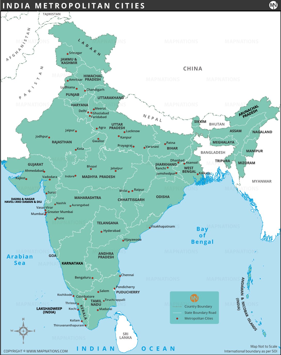
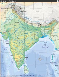
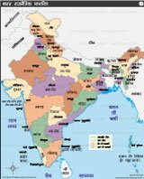
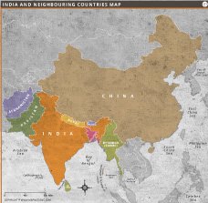
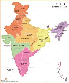
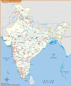
This detailed map of India showcases major cities across all states and union territories, highlighting state capitals, important towns, and international borders. Each state is distinctly color-coded for easy identification, with clear markings for major cities such as Mumbai, Delhi, Bengaluru, Hyderabad, Kolkata, and Chennai. The map includes the entire Indian subcontinent, extending from the northern territories of Ladakh and Jammu & Kashmir to the southern tip of Kanyakumari. It also marks neighboring countries like China, Nepal, Bhutan, Bangladesh, Pakistan, and Myanmar.
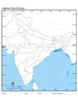
The map shows all 28 states and 8 union territories with clear boundaries. Major state capitals such as New Delhi, Mumbai, Chennai, Kolkata, and Bengaluru are prominently marked, as well as other important cities such as Jaipur, Hyderabad, Ahmedabad, and Guwahati. The map also includes the union territories of Jammu and Kashmir, Ladakh, and Puducherry, emphasizing their administrative importance.
This map is ideal for students, researchers, and anyone seeking a detailed representation of India's political geography. It serves as an excellent resource for understanding the administrative structure, population distribution, and location of major cities. Additionally, it helps to see the proximity of states with neighboring countries and water bodies, which is important for topics such as trade, tourism, and regional planning.
The colorful design enhances readability, with each state and union territory shaded differently for easy identification. Whether used for school projects, competitive exams, or general knowledge enhancement, this map is a valuable educational tool. It also serves as a handy reference for professionals working in fields such as geography, mapping, and urban planning.


- Afghanistan
- Albania
- Algeria
- Andorra
- Angola
- Antigua and Barbuda
- Argentina
- Armenia
- Australia
- Austria
- Azerbaijan
- Bahrain
- Bangladesh
- Barbados
- Belarus
- Belgium
- Belize
- Benin
- Bhutan
- Bolivia
- Bosnia and Herzegovina
- Botswana
- Brazil
- Brunei
- Bulgaria
- Burkina Faso
- Burma (Myanmar)
- Burundi
- Cabo Verde
- Cambodia
- Cameroon
- Canada
- Central African Republic
- Chad
- Chile
- China
- Colombia
- Comoros Islands
- Democratic Republic of the Congo
- Costa Rica
- Cote d'Ivoire
- Croatia
- Cuba
- Cyprus
- Czechia
- Denmark
- Djibouti
- Dominica
- Dominican Republic
- Ecuador
- Egypt
- El Salvador
- England
- Equatorial Guinea
- Eritrea
- Estonia
- eSwatini (formerly Swaziland)
- Ethiopia
- Federated States of Micronesia
- Fiji
- Finland
- France
- Gabon
- The Gambia
- Georgia
- Germany
- Ghana
- Greece
- Grenada
- Guatemala
- Guinea
- Guinea-Bissau
- Guyana
- Haiti
- Holy See
- Honduras
- Hungary
- Iceland
- India
- Indonesia
- Iran
- Iraq
- Ireland
- Israel
- Italy
- Jamaica
- Japan
- Jordan
- Kazakhstan
- Kenya
- Kiribati
- Kosovo
- Kuwait
- Kyrgyzstan
- Laos
- Latvia
- Lebanon
- Lesotho
- Liberia
- Libya
- Liechtenstein
- Lithuania
- Luxembourg
- Madagascar
- Malawi
- Malaysia
- Maldives
- Mali
- Malta
- Marshall Islands
- Mauritania
- Mauritius
- Mexico
- Moldova
- Monaco
- Mongolia
- Montenegro
- Morocco
- Mozambique
- Namibia
- Nauru
- Nepal
- Netherlands
- New Zealand
- Nicaragua
- Niger
- Nigeria
- North Korea
- Northern Ireland
- Norway
- Oman
- Pakistan
- Palau
- Panama
- Papua New Guinea
- Paraguay
- Peru
- Philippines
- Poland
- Portugal
- Puerto Rico (USA)
- Qatar
- North Macedonia
- Romania
- Russia
- Rwanda
- Saint Kitts and Nevis
- Saint Lucia
- Saint Vincent & the Grenadines
- Samoa
- San Marino
- Sao Tome and Principe
- Saudi Arabia
- Scotland
- Senegal
- Serbia
- Seychelles
- Sierra Leone
- Singapore
- Slovakia
- Slovenia
- Solomon Islands
- Somalia
- South Africa
- South Korea
- South Sudan
- Spain
- Sri Lanka
- Sudan
- Suriname
- Sweden
- Switzerland
- Syria
- Tajikistan
- Taiwan
- Tanzania
- Thailand
- The Bahamas
- Timor-Leste
- Togo
- Tonga
- Trinidad and Tobago
- Tunisia
- Turkey
- Turkmenistan
- Tuvalu
- Uganda
- Ukraine
- United Arab Emirates
- United Kingdom
- United States of America
- Uruguay
- Uzbekistan
- Vanuatu
- Western Sahara
- Venezuela
- Vietnam
- Wales
- Yemen
- Zambia
- Zimbabwe
